Shopping cart
0 items - € 0.00
Facebook Twitter
   

Atlas of the War on Texel - Waning and Decline of the Atlantic Wall

Atlas of the War on Texel - Waning and Decline of the Atlantic Wall
Author: Dijkstra, Paul

Language: Dutch

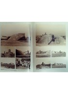
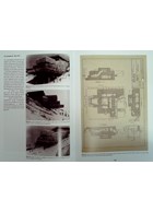
The book describes - with the use of more than 500 photos, drawings, plans and maps - the rise and fall of the bunkers of the Atlantic Wall on the Dutch island of Texel. The book also offers a comprehensive overview - using the drawings and plans of the BRV - of the German bunkers that were built on the island!


Description

Dear Friends,

The title of the book is in our opinion a bit "misguiding". This is NOT a book full of maps, as you might expect. It is MUCH more!

It is a detailed inventory of the bunkers that were built as part of the German Atlantikwall on the Dutch island of Texel, which protected the naval base of Den Helder.

The island of Texel was littered with bunkers. Bunkers that were part of Marine Küsten Batterien, Heeres Küstenbatterien, Flak-Batterien, Radar Stations, Communication bunkers, etc.

This book shows them all with the help of HUNDREDS of photos (most of them in colour!), drawings, plans and maps. Photos taken by the German soldiers, but also photos taken right after the war or during their demolition!

A MUST for anyone with a serious interest in bunkers in general and in GErman bunkers of the Atlantikwall in particular!

Original title Atlas van de Oorlog op Texel - Herfsttij en Ondergang van de Atlantikwall
Author Dijkstra, Paul
Languages Dutch
Subject CF - Modern fortifications - 20th century
Period World War Two
Location Texel, The Netherlands
Categories Photobooks, Textual books, Antiquarian books, Drawings, Plans and maps

Preview